I'm sorry for not having posted in a long while. It's not because I've avoided the outdoors, nor did I leave my camera at home, but forgot I should be sharing photos and stories with you.
Most weekends from November through January, when I wasn't shoveling I was snowshoeing. I kept the trail packed up until the big snowfall that so far has been the last big snowfall.
Showing posts with label marble. Show all posts
winter expands the wilderness
![]() |
| McKee Pond and the Raggeds |
an explosion of autumn mountain color
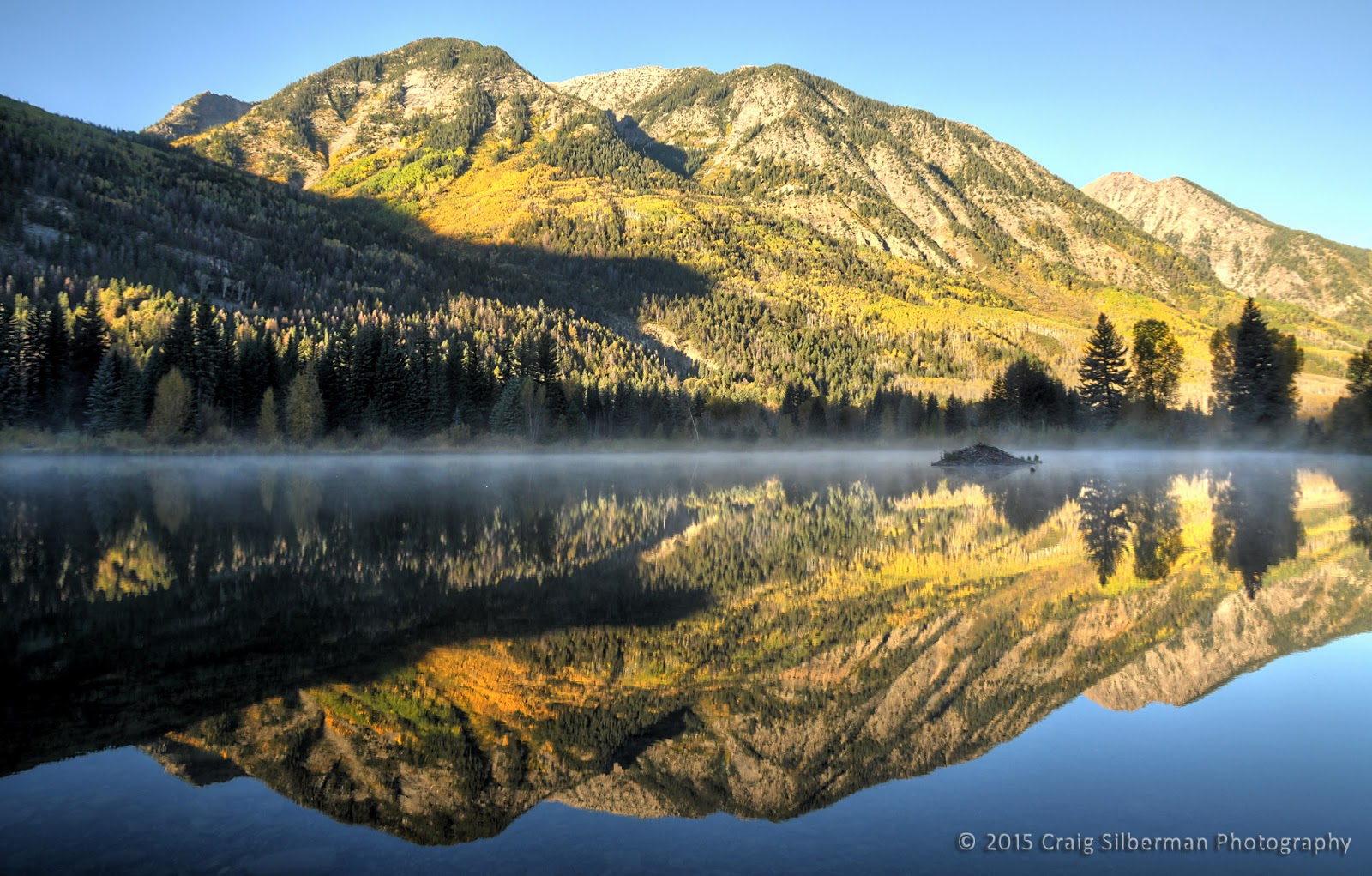
Heavy spring rains created a fungus that caused many aspens to drop their leaves early this year, but there were enough of those that didn't to create some spectacular landscapes. These were taken not in the wilderness (which is filled with hunters now), but in the Crystal River valley, between Redstone and Marble, Colorado.
![]() |
| McKee Pond, near Marble |
![]() |
| click on this pond panorama to see it better |
Yule Creek
No matter how many photos I share of this place, it never gets spoiled. Even last week, when there were a half dozen cars at the trailhead, we saw only one person on the trail (the trailhead serves two trails, and many take the less scenic one, for reasons that elude me).
![]() |
| a big ass panorama that you have to click to appreciate |
![]() |
| old steam engine on the trail |
Autumn Mountain Splendor
Rain, fog, clouds, and mountains
We're almost at the cusp of monsoon season and early autumn, when overnight rains produce some fantastic low clouds in the morning.
Today I found a break in the weather to take some photos at McKee Pond near Marble, Colorado.
Huntsman's Ridge
Running north from McClure Pass, Huntsman's Ridge wraps around the west side of the Coal Basin west of Redstone, Colorado. The trail climbs about 1,700 feet before leveling out. This used to be a 4WD road, but the gate appears to have been closed the entire season (it was open last fall when I went up there, and a number of hunters had made camp part way up). The sign says that dirt bikes and ATVs can still use it, but they obviously are not. Given the downed trees across the road/trail, I can't imagine how even an ATV could navigate this.
I wasn't in the mood to drive far for a hike today, and this one is just a few miles from my home. I like how steeply it rises (great for exercise), how quiet it is (I was surprised when I saw two other hiking parties on my way down), and the incredible views of the Crystal River and North Fork (Gunnison) valleys.
![]() |
| panorama from the meadow |
![]() |
| crooked aspens |
The Yule Creek Valley in the Raggeds Wilderness
My home in the Crystal River valley is bordered to the northeast by the Snowmass-Maroon Bells Wilderness and to the southeast by the Raggeds Wilderness. There are many fantastic trails in this under-traveled area. My favorite is easily Yule Creek. From just below the top of the quarry road south of Marble, Colorado, the trail climbs about 1,500 feet in the first mile and a half. At this point, you're on an overlook above a beautiful hanging valley.
I call those three peaks "the Baby Bells," because of their resemblance to the Maroon Bells - the most photographed feature in the state. The taller one on the right is Mt. Justice. The wide area below is Thompson Flats.
If you descend to Thompson Flats, there's a stream crossing (which is running very high and fast this year). I recommend a pair of water shoes, as I try my best to keep my shoes and socks dry for my hiking comfort.
From here, the trail is relatively easy for the next mile or two as it winds through wildflower meadows and past rapids and small waterfalls. Eventually it climbs to Yule Pass. At this point, some hikers will do an about-face and traverse the slope to Yule Lakes, whose exit streams crossed the trail along the way up.
I call those three peaks "the Baby Bells," because of their resemblance to the Maroon Bells - the most photographed feature in the state. The taller one on the right is Mt. Justice. The wide area below is Thompson Flats.
If you descend to Thompson Flats, there's a stream crossing (which is running very high and fast this year). I recommend a pair of water shoes, as I try my best to keep my shoes and socks dry for my hiking comfort.
From here, the trail is relatively easy for the next mile or two as it winds through wildflower meadows and past rapids and small waterfalls. Eventually it climbs to Yule Pass. At this point, some hikers will do an about-face and traverse the slope to Yule Lakes, whose exit streams crossed the trail along the way up.
Marble, Colorado
Marble, Colorado is an unsightly little town nestled in one of the most beautiful valleys you'll ever see. Sandwiched between the Raggeds and Snowmass-Maroon Bells wilderness areas, and with Lead King Basin to the east, Marble is a great jumping-off point for many backcountry trips.
Backpacking and day-hikes, horseback trips, and fishing are just a few of the many things you can do in the Crystal River valley around Marble.
Some of my favorite hikes in the area are Carbonate Creek, North Lost Creek, Geneva Lake, and Yule Creek. Backpackers will want to hike into Lead King Basin, where there are many campsites, and the scenery is unparalleled.
The Chair Mountain Ranch has cabins you can rent for any length of time. Dave and Linda are great hosts, and will do all they can to ensure you have a great stay.
Marble is about twenty five miles south of Carbondale. Take Highway 133 south to Gunnison County Road 3 (affectionately known as "the Marble road").
![]() |
| The Marble airstrip is quiet for all but a couple weekends a year. |
Backpacking and day-hikes, horseback trips, and fishing are just a few of the many things you can do in the Crystal River valley around Marble.
Some of my favorite hikes in the area are Carbonate Creek, North Lost Creek, Geneva Lake, and Yule Creek. Backpackers will want to hike into Lead King Basin, where there are many campsites, and the scenery is unparalleled.
The Chair Mountain Ranch has cabins you can rent for any length of time. Dave and Linda are great hosts, and will do all they can to ensure you have a great stay.
Marble is about twenty five miles south of Carbondale. Take Highway 133 south to Gunnison County Road 3 (affectionately known as "the Marble road").
Huntsmans Ridge in Winter
Snowshoeing up Huntsmans Ridge this morning, I was puzzled as to why, the higher I went, I still hadn't seen anyone. When I crested the ridge, about 1,500 feet above McClure Pass, I saw my answer. The skiers that preceded me skied off the north side, into the valley below. The south side, while much safer, and the route everyone takes up, was pretty settled and it would have been a challenge to carve turns there. The snow on the north side was probably outstanding, but one needs to have good avalanche knowledge and some well-equipped friends before trying such a thing.
Huntsmans Ridge extends north of McClure Pass, on highway 133. It has its own parking area, or you can park at the top of the pass and walk downhill a hundred or so yards.
Scenic Winter Vista
I first discovered this point several years ago when I was hiking up Huntsmans Ridge in the summer. After reaching the ridge, I saw a game trail leading down it, and followed that out to the end, where one is treated to a nearly 360 degree view. To the north, you can see Mt. Sopris, and to the south, the North Fork (of the Gunnison) valley. This shot is taken to the southeast, with (from left to right) Treasure Mountain, Ragged Mountain, and Chair Mountain most prominent. You also get a nice view of the Crystal River Valley at the bend where the settlement of Placita used to exist.
I never dreamed of being able to enjoy this view in winter, but was able to reach it by snowshoes this weekend. I broke a lot of trail on Saturday, so when I returned on Sunday, was able to go even higher. I would have liked to shoot this from closer to the edge, but didn't want to risk having the cornice give way, and take me on an express ride to the bottom.
Huntsmans Ridge can be reached from McClure Pass, near Marble and Redstone, Colorado, a half hour north of Paonia. The trail runs north of the pass, while to the south is Ragged Mountain Road, an easier and thus more traveled route.
Beaver Lake in Marble, Colorado
It won't be long before we'll be able to travel past Beaver Lake into Lead King Basin. For now, however, this is the end of the road. A late April, early May storm is leaving lots of snow behind, even though much of it melts as the sun comes out in between squalls. It was during one of these breaks yesterday morning that I drove into Marble to get some shots of the cloud-shrouded mountains reflected in both Beaver Lake and the pond downstream of town.
Colorado riverscape in both color and black & white
We carried our snowshoes down to the river this morning, thinking they would be needed in the deep snow. However, the freeze/thaw cycles of the last couple weeks left the surface rather firm, and we were able to get around quite easily with just boots. If this condition exists at higher elevations, we might be able to get into the deep backcountry much earlier this spring.
So we carried our snowshoes, instead of wearing them, and set them down to take photos along the Crystal River. This shot, below Chair Mountain, is at one of those bends in the river where you can walk out into the stream this time of year.
Snowshoeing in the Colorado winter landscape
Even with snowshoes on, we were sinking over a foot deep in the snow. Had we been wearing only boots, I can't imagine how difficult it would have been to travel very far. The cold weather this winter is preserving the snow and keeping it light and fluffy. I was really surprised it hadn't settled more.
Starting near the Bogan Flats group camp, downstream of Marble, Colorado, we traveled up the Crystal River until the steep slope turned us back. A snow squall was fully upon us by the time we returned to the car. Earlier the area was bathed in sunshine.
The winter landscape, especially when the blue skies are obscured by clouds, is rather monochromatic. Thus shooting landscapes in black and white, instead of color, just seems like a natural thing to do. I like the results.
Chair Mountain and the Crystal River valley
This area sees a decent amount of visitors in the summer, and seems mobbed in autumn, when the aspens are in full color, but winter is pretty quiet. Exploring this bend in the river, below McClure Pass, is one of my favorite activities when I'm not in the mood to travel far. The trail was packed enough that you could walk it in boots, but the deep snow made for quite a challenge when I stepped off the trail. I think I'll wear snowshoes the next time I go down there.
Colorado's Crystal River


Late autumn and early winter offer some incredible photo opportunties on the Crystal River. These stretches will be almost completely snow-covered soon. Right now, with the mixture of ice and open water, they have so much more visual interest.
These two photos were taken between Marble and Redstone, Colorado.
Subscribe to:
Posts (Atom)